- Home
- At a Glance
-
-
About Us
-
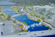 The goal of the St. Charles Active River Project is to create a lively riverfront environment and experience that is the centerpiece of the community.
-
-
- Purpose
- News & Events
- VIDEOS
- Contact Us
Master Plan
Strategy
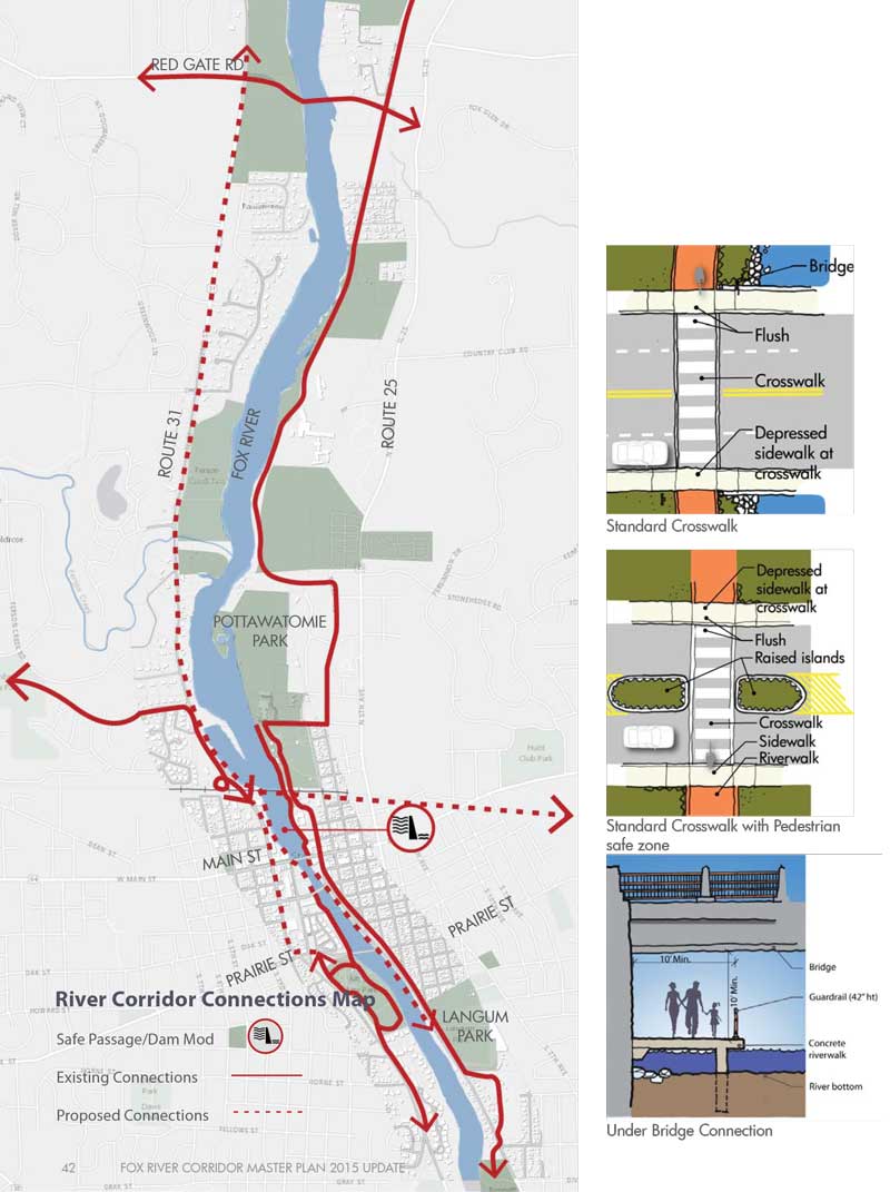
Connections Vehicular, bicycle, and pedestrian connections are critical to the success of the corridor. Vehicular connections have traditionally taken precedence, although providing continuous pedestrian access, regional bicycle trail connections, and safe crossings are important factors to create a complete circulation system.
 Delineated Crosswalk with Pedestrian Safe Zone
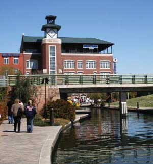 Under Bridge Connection
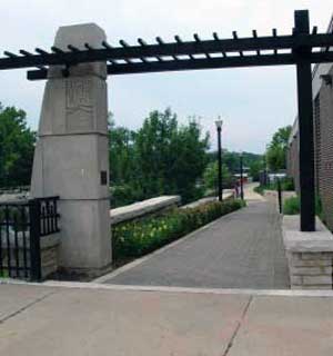 Gateway
Maintain existing connections, and:
- Complete both sides of the Riverwalk
- Extend the Fox River Trail, both sides, north of RR
- Extend Great Western Trail
- Modify the dam, create a navigable route
- Signature bridge
- Grade separated where possible, safe at-grade where necessary
- Gateways and wayfi nding
Complete both sides of the Riverwalk
As described previously, the riverwalk can become an attraction in its own right, but it also provides important pedestrian connections along the riverfront and throughout the downtown.
Extend the Fox River Trail and Great Western Trail
Similarly, the trail system is an attraction that can be extended to provide improved bicycle and pedestrian connectivity throughout the community and beyond.
Modify the dam, create a more navigable route
We don’t often think about the river as a connection, but currently the dam is an impediment to providing river connectivity. Modifying the dam and creating a navigable route completes a waterway connection that has been absent for many years. This would also allow this section of the river to become part of the National Water Trails System.
Signature bridge
The northwest section of the downtown is somewhat disconnected from the riverfront and a signature pedestrian bridge would provide a direct connection to the river and the east bank in addition to becoming an iconic riverfront structure in the community.
Grade separated crossings where possible, safe at-grade crossings where necessary
Separating pedestrians and bicycles from vehicular traffic at crossings is the most desirable solution to create a safe and comfortable environment. Wherever possible, provide grade separated crossings, but where impractical, improve at-grade crossings with traffic calming devises, signals, and signage.
Gateways and wayfinding
Gateway components can define the limits of the community and provide a clear identity for the riverwalk. A comprehensive family of wayfinding signage can communicate the desired image while helping people navigate along the riverfront.
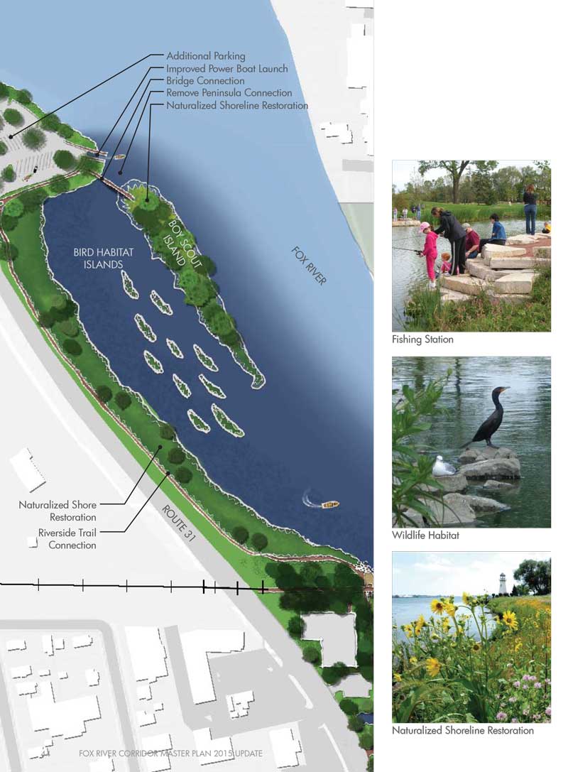
River Corridor Connections Map